Blog Details
Essential Navigation Equipment for Safe and Accurate Travel
Navigation is the process of determining one’s position and planning and following a route. Navigation equipment plays a vital role in facilitating this process across various domains—land, sea, air, and even space. Whether it is a mariner finding the safest course, a pilot maneuvering through the skies, or a hiker exploring remote terrains, navigation tools are crucial for safety, accuracy, and confidence in movement.
In this article, we explore the different types of navigation equipment, how they work, and their importance in various fields.
1. What Is Navigation Equipment?
Navigation equipment refers to devices and instruments used to determine direction, location, and distance. These tools help individuals or machines find their way from one point to another accurately. Navigation equipment ranges from traditional tools like compasses and maps to advanced digital systems like GPS and radar.
Depending on the type of travel—land, sea, or air—the equipment used can differ significantly. Yet, all serve the same fundamental purpose: to guide, locate, and assist in movement.
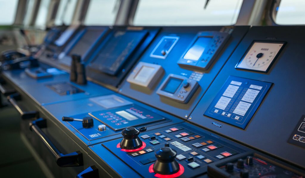
2. Types of Navigation Equipment
A. Compass
The compass is one of the oldest and most reliable navigation tools. It shows direction relative to the Earth’s magnetic poles. Today’s compasses are often combined with digital displays in smartphones and other handheld devices, offering enhanced accuracy and user-friendly interfaces.
Uses:
-
Orienteering and hiking
-
Maritime and aviation backup navigation
-
Military operations
B. Global Positioning System (GPS)
GPS devices use satellite signals to provide real-time location data anywhere on the globe. GPS has revolutionized navigation, offering accurate position tracking, speed measurement, and route planning.
Uses:
-
Automotive navigation
-
Maritime and aviation guidance
-
Personal navigation in hiking and cycling
-
Fleet and logistics tracking
C. Radar (Radio Detection and Ranging)
Radar systems use radio waves to detect objects and measure distances. In navigation, radar helps detect land masses, other vessels, and weather systems. Marine and aircraft radars are essential for navigating in poor visibility conditions.
Uses:
-
Marine navigation
-
Air traffic control
-
Weather monitoring
D. Sonar (Sound Navigation and Ranging)
Sonar uses sound waves to detect underwater objects. It is primarily used in marine navigation to measure depth and detect underwater hazards or other vessels.
Uses:
-
Submarine navigation
-
Fishing vessel depth tracking
-
Underwater exploration
E. Gyroscope and Inertial Navigation System (INS)
A gyroscope measures angular velocity, and when combined with accelerometers in an inertial navigation system, it helps determine movement and orientation without external signals.
Uses:
-
Aircraft and spacecraft navigation
-
Autonomous vehicles
-
Submarines
F. Nautical Charts and Maps
Though digital alternatives are now popular, paper nautical charts and topographic maps still serve as reliable backup tools. They display information like terrain, water depth, hazards, and air routes.
Uses:
-
Marine and aviation route planning
-
Emergency backups
-
Military navigation
G. Altimeter
An altimeter measures altitude above sea level. Barometric altimeters calculate altitude using air pressure, while GPS-based altimeters rely on satellite data.
Uses:
-
Aviation and paragliding
-
Mountain climbing
-
Aerospace applications
H. Automatic Identification System (AIS)
AIS is a tracking system used on ships and by vessel traffic services. It provides information like identity, position, course, and speed of nearby vessels.
Uses:
-
Collision avoidance at sea
-
Coastal monitoring
-
Maritime traffic management
3. Importance of Navigation Equipment
Safety
Accurate navigation reduces the risk of accidents, especially in challenging environments such as oceans, mountains, or bad weather. Navigation tools help avoid obstacles, maintain safe routes, and ensure timely arrivals.
Efficiency
Using advanced tools like GPS and radar ensures efficient route planning. This saves time, fuel, and effort, especially for transportation companies, airlines, and shipping lines.
Situational Awareness
Modern navigation systems provide real-time information about surroundings, weather conditions, traffic, and terrain. This helps in making informed decisions, particularly in high-stakes environments like aviation or military operations.
Rescue and Emergency Operations
Navigation equipment is vital in search and rescue missions. GPS coordinates help pinpoint exact locations, and radar/sonar assists in locating people or objects in poor visibility conditions.
The diversity of cargo types makes these ships vital to many industries and economies.
4. Navigation in Different Domains
A. Marine Navigation
Marine navigation heavily depends on tools like radar, sonar, GPS, AIS, and compasses. Mariners use nautical charts and digital navigation systems (ECDIS) to plan and follow safe routes. Depth sounders and echo sounders help avoid grounding and detect underwater hazards.
B. Aviation Navigation
Pilots use a combination of GPS, altimeters, gyroscopic systems, and communication tools for precise air travel. Flight management systems (FMS) and autopilots integrate navigation data to optimize flight performance and reduce workload.
C. Land Navigation
From simple road maps to high-end automotive GPS systems, land navigation tools are widely used. In remote areas, hikers and geologists may rely on compasses, topographic maps, and handheld GPS units.
D. Space Navigation
Spacecraft use star trackers, gyroscopes, and deep space networks for navigation. Due to the absence of GPS beyond Earth, space missions rely on onboard sensors and ground-based tracking systems.
5. Evolution of Navigation Equipment
The field of navigation has seen tremendous evolution over centuries. Ancient methods involved celestial navigation, using stars and the sun. Magnetic compasses revolutionized seafaring in the medieval period. The 20th century saw the rise of radar and radio navigation, while the modern era has been defined by satellite-based systems like GPS, GLONASS, Galileo, and BeiDou.
Today’s integrated systems combine GPS with real-time traffic data, weather alerts, and AI-driven route optimization. Autonomous vehicles and drones now use sophisticated navigation systems involving sensors, machine learning, and remote data.
6. Future Trends in Navigation
The future of navigation lies in smarter, more interconnected systems. Technologies such as:
-
AI and machine learning for predictive routing
-
Augmented Reality (AR) for visual navigation in vehicles and aviation
-
Quantum gyroscopes for highly precise inertial navigation without satellites
-
Internet of Things (IoT) for connected fleet tracking and data sharing
These advancements will further improve accuracy, safety, and efficiency.
Conclusion
Navigation equipment is indispensable in modern life, from guiding personal journeys to managing global logistics and aerospace missions. As technology evolves, navigation tools will become even more accurate, compact, and intelligent—continuing to shape the way we explore and move through the world.
Whether you’re a sailor navigating uncharted waters or a commuter finding the quickest way home, reliable navigation equipment is your most trusted companion.